The GISS V4 land/ocean temperature anomaly was 0.93°C in June 2020, down from 1.04°C in May. That compares with a 0.076deg;C fall in the TempLS V4 mesh index. As with TempLS, Gistemp still had June tied with 2019 as the warmest June in the record. Jim Hansen's report is here.
As usual here, I will compare the GISS and earlier TempLS plots below the jump.
Tuesday, July 14, 2020
Tuesday, July 7, 2020
June global surface TempLS down 0.076°C from May.
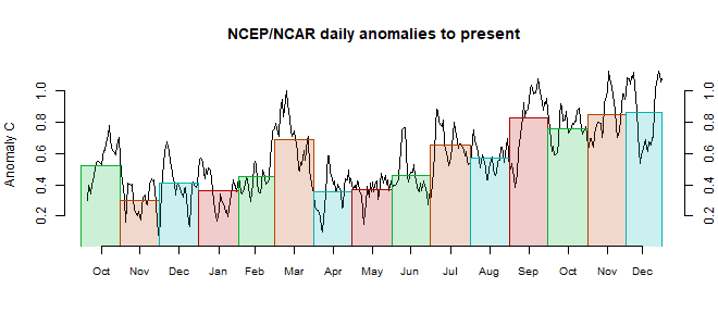
The TempLS mesh anomaly (1961-90 base) was 0.779deg;C in June vs 0.855°C in May. This drop was less than the fall in the NCEP/NCAR reanalysis base index, which was 0.114°C. The UAH satellite data for the lower troposphere also showed a fall of 0.11°C.
Rather surprisingly, despite two successive and substantial monthly falls, June 2020 was still the warmest June in the record, just ahead of 2019 (0.775°C). Because of the small margin, this status may change with late data.
The great warmth of E Siberia persists, although W Russia was cool, in a belt extending down to India. Much of Europe was warm, as was Antarctica.
Here is the temperature map, using the LOESS-based map of anomalies.
 As always, the 3D globe map gives better detail.
Rather surprisingly, despite two successive and substantial monthly falls, June 2020 was still the warmest June in the record, just ahead of 2019 (0.775°C). Because of the small margin, this status may change with late data.
The great warmth of E Siberia persists, although W Russia was cool, in a belt extending down to India. Much of Europe was warm, as was Antarctica.
Here is the temperature map, using the LOESS-based map of anomalies.
 As always, the 3D globe map gives better detail.
Saturday, July 4, 2020
NCEP/NCAR reanalysis June 2020 surface temperature down 0.114°C from May.
The Moyhu NCEP/NCAR index came in at 0.223°C in June, following 0.337°C in May, on a 1994-2013 anomaly base. May was already down from April, so the warm start to 2020 has definitely faded. Still, the June average was similar to June 2017 and 2018. The UAH TLT satellite temperature also declined by 0.11°C
The most notable feature was a band of cool from India north to the Arctic ocean. Generally Russia did not continue the remarkable warmth of the year to May. There was a warm band from Iran to Norway, through E Europe, and a cool strip north of the Mediterranean. Antarctica seems mostly warm.

The most notable feature was a band of cool from India north to the Arctic ocean. Generally Russia did not continue the remarkable warmth of the year to May. There was a warm band from Iran to Norway, through E Europe, and a cool strip north of the Mediterranean. Antarctica seems mostly warm.

Subscribe to:
Posts (Atom)


