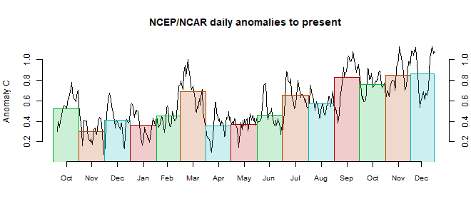
NW Canada down into the US midwest was cool. E Siberia was warm, but W Russia was cool. The extremes were around Antarctica, with parts of the adjacent ocean being very cool, but warm areas on land, especially W Antarctica. Australia was cool.

This post is part of a series that has now run for some years. The NCEP/NCAR integrated average is posted daily here, along with monthly averages, including current month, and graph. When the last day of the month has data (usually about the 3rd) I write this post.
The TempLS mesh data is reported here, and the recent history of monthly readings is here. Unadjusted GHCN is normally used, but if you click the TempLS button there, it will show data with adjusted, and also with different integration methods. There is an interactive graph using 1981-2010 base period here which you can use to show different periods, or compare with other indices. There is a general guide to TempLS here.
The reporting cycle starts with a report of the daily reanalysis index on about the 4th of the month. The next post is this, the TempLS report, usually about the 8th. Then when the GISS result comes out, usually about the 15th, I discuss it and compare with TempLS. The TempLS graph uses a spherical harmonics to the TempLS mesh residuals; the residuals are displayed more directly using a triangular grid in a better resolved WebGL plot here.
A list of earlier monthly reports of each series in date order is here:


Barring some oddity, looks like GISS will report 2019 as the warmest JJA on record. Looking ahead though, the indications are that we'll be firmly in negative ENSO territory over November-February, which makes a new annual record in 2020 very unlikely. Should be a top 5 year though, pushing out 2018.
ReplyDelete@PaulS:
DeleteYes, the JJA19 temperature anomaly in GISS.v4 equal or larger then the current record has a probability of 99.4% in my statistical model. An the year 2019 will likely be the second warmest year in GISS.v4.
But where do you get the ENSO information? Here only one model predicts negative ENSO
http://www.bom.gov.au/climate/enso/#tabs=Outlooks
So if ENSO remains neutral, 2020 may be as warm as 2019, or even 2016.
New annual record (or equal to old record) for GISS.v4 in my model for 2019 and 2020 is now, with 9% and 48% probability, respectively. But of course it may suffer bias from losing MEI information.
Uli,
ReplyDeleteWell, Nino3.4 has already just dipped below the zero line according to NOAA, and Nino1+2 has been negative for a couple of months - often a useful precursor. Also the pattern of subsurface equatorial temperature variability - cooling firmly into negative anomalies in the East with an upturn towards warming in the West. A classic La Nina pattern, although I'm not sure it will pass the La Nina threshold.
Currently looking likely that this month will be the warmest September on record but further records this year I think are very unlikely. Another point on my negative ENSO outlook is that both the NCEP and ERA reanalyses show firmly negative-variability-indicating data over the last six months for equatorial zonal wind stress.
ReplyDeleteIn other climate data news, it is now 3 full years that the NSIDC daily Antarctic sea ice data has stayed below the 1981-2010 average, which is unprecedented in the record. A couple of years ago there were statistically significant (OLS) positive trends for all months. Now only the trend for Octobers remains significant, and there's a good chance that changes next month. Furthermore, it's possible that the trend for November months will go negative this year (though nowhere near significance). Perhaps time to consider that the appearance of increasing Antarctic sea ice in the satellite record is actually largely due to decadal/multi-decadal variability and an unfortunately highly unrepresentative start date of 1979, and that the long-term trend will be downwards, roughly in-line with CMIP5 projections.
Interesting on this point about Antarctic sea ice that NSIDC have just switched from highlighting the record highest in 2014 to the record lowest in 2017 and 2018 on their graphs.
DeleteToday, the JAXA Arctic sea ice extent went below the minimum of 2016 and became the second lowest on record. If this rather late decrease continues, the extent will probably go below 4 million km2 in the next few days..
ReplyDelete